Chelsea
One of the best ways to get around Istanbul is using public transport. It’s quick, affordable, and there are lots of options available, you just need to know how to use it!
Istanbul is a huge city that is spread across two continents and divided by multiple different waterways. One of my favourite things to do is to traverse the city on foot where possible, because in my opinion it allows you to see more and really soak up the atmosphere. BUT this can also lead to easily 20000+ steps a day, which I know it everyone’s idea of a good time. If walking isn’t your thing, or you have limited time, Istanbul’s public transport network is a great option!
This blog post will give you a rundown of all the public transport options in Istanbul, some tips and tricks on how to use them, outline the most common routes for tourists, and provide information on how to get an Istanbulkart card.
A guide to Istanbul Public Transport
I’ll be honest, I have a love-hate relationship with public transport in my home-town – I only use it when absolutely necessary. But for some reason, when I’m travelling, using public transport is one of my favourite things to do.
I know that Istanbul is enormous and very busy, and navigating public transport can feel intimidating, but I guarantee you it’s easy once you get the hang of it. It’s also a better option risking a taxi driver trying to scam you, or getting stuck in the crazy Istanbul traffic.
A quick lay of the land…
Firstly, it can be helpful to know the areas different areas of Istanbul, which will help you understand some of the terminology used in this post. In the image below, I’ve highlighted the key areas of Istanbul and put a description of each.

Orange – The Golden Horn: This waterway inlet on the European side of Istanbul separates the Karaköy and Eminönü areas. The famous ‘Galata Bridge’ is one of the bridges that connects these two areas.
Pink – Bosphorus Strait: This strait connects the Black Sea in the north with the Sea of Marmara in the south. Istanbul famously stretches across two continents, and the Bosphorus is what separates the two. Europe sits to the west (left on the map) of the Bosphorus Strait, and Asia sits to the east (right on the map)
Green – Eminönü and surrounds: The green section of this map is the historic centre of Istanbul. This is where the neighbourhoods of Eminönü, Sirkeci, and Sultanahmet are located. This is also home to Haliç Metro (train) station and Sirkeci train station (Marmaray line).
Yellow – Karaköy and surrounds: This region of Istanbul has some historical sights, but is considered the more modern side of Istanbul. The neighbourhoods of Karaköy, Galata, Taksim, and Beyoğlu are located in this region. There are trams, ferries, the Metro (trains) and funicular lines here.
Purple – Asian (Anatolian) Side of Istanbul: The Asian side of Istanbul is the ‘less visited’ side, but is certainly worth your time. This region is home to the neighbourhoods of Kadıköy and Üsküdar.
IstanbulKart Card
What is an IstanbulKart Card?
An IstanbulKart card is needed to travel on public transport. Although some public transport options in Istanbul allow you to ‘tap on’ using a credit card, this method has not been introduced fully across the public transport network. Therefore, I would recommend getting a red IstanbulKart card instead (see image below). This physical card allows you to add money and then ‘tap on’ across all of the public transport options, including the ferries, trams, trains, funicular, and buses. It’s also a nice souvenir at the end of your trip!
The IstanbulKart card is different to the Istanbul City Card. The blue Istanbul City Card is marketed at tourists, and although it seems like a great option, it is very expensive, and you’re highly unlikely to use it enough to justify the price.
Additional note – the IstanbulKart card can be used to access public toilet blocks in main tourist areas (e.g., the facilities near the Hippodrome in Sultanahmet)
Where to buy an IstanbulKart Card:
You can buy an IstanbulKart card at the ticket machines located outside most tram stops, train stations, ferry and bus terminals (see image below). These yellow machines are easy to find, and you’ll see them outside all of the main tourist stops. You may also be able to buy a card from local convenience stores and kiosks (Büfe).
How to buy an IstanbulKart card and top it up:
Each ticket machine has the option to choose a preferred language – do this first. Then the machine will guide you through all options on the screen and it will also verbally speak to you. You can buy a new IstanbulKart card at these machines, and also top up new and existing cards.
At some machines, there may be some people wanting to help you. I would suggest declining and working it out yourself. While there are some people who are genuinely willing to help, there are some scammers who will expect you to pay them.
How much does an IstanbulKart card cost?
The IstabulKart card itself costs ₺165* (Turkish Lira; approx €3), then you can ‘top up’ the card with money for transit fares. Payment can be made using cash or card. I use public transport a lot in Istanbul, and I usually add ₺200 to start with. It’s very easy to top up again as needed.
One IstanbulKart card can be shared between up to five people. For example, if you’re travelling with a friend or as a family, you can tap on and go through the turnstile, and then pass the card back to someone else to use. BUT there is a monthly top-up limit of ₺2,750* per card per month (approx €50). If there are five of you, and you’re in Istanbul for an extended period of time and will be using public transport often, it may be easier to have your own separate cards.
Fares on public transport can vary. Most trams, buses and trains are approx ₺46* per trip. Standard ferry trips across the city range between approx ₺50-80* depending on the line. Ferry routes to further destinations, such as the Princess Islands, can be approx ₺150* for a return trip.
You can also use your IstanbulKart card for the official Long Bosphorus Tour. This tour goes to Anadolu Kavağı at the northern end of the Bosphorus Strait and is approx ₺320* for a return trip. However, I’ve got some tips on how to do this trip cheaper – see my blog post How to Visit Anadolu Kavagi for details.
How to use your IstanbulKart card
When arriving at tram, train, funicular, or ferry terminals, you will be required to tap your IstanbulKart card, and then move through the turnstiles. On buses, you will can tap your card on the machine as you board the bus.
Types of Public Transport in Istanbul & How to Use Them
Tram
If you’re walking around the main tourists areas of Istanbul, it’s nearly impossible to miss the trams! If you catch the tram in Istanbul, you’ll most likely be on the T1 Kabataş–Bağcılar Tram Line. This line covers the European side of Istanbul and crosses the Golden Horn waterway.
When arriving at the tram stop, there is a list of stops the tram line travels through – just follow the direction of traffic. The trams can be quite busy, but they do run every couple of minutes, so if you can’t fit on the first one, just wait for the next.
The most popular tourist stops on the T1 line:
- Beyazıt–Kapalıçarşı — Grand Bazaar
- Sultanahmet – Hagia Sophia, Blue Mosque, Hippodrome (German Fountain & Obelisks), Basilica Cistern
- Gülhane – Topkapı Palace
- Sirkeci – Historic Railway Station
- Eminönü – Spice Bazaar, Galata Bridge, Ferry terminals, and access to Bosphorus Cruises
- Karaköy – Galata Tower
- Kabataş – Waterfront and more ferry terminals and connections
Ferry
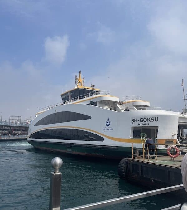
The ferries are BY FAR my favourite way to get around Istanbul. There is something special about seeing the Istanbul skyline from the water, especially on a beautiful sunny day. Some days, I’ll just jump on a random ferry and see where it takes me.
The main ferry lines usually run every 15-20 minutes, whereas some of the less popular routes might be every 40-60 minutes. You can find the timetable for each ferry line on the Şehir Hatları website.
At some of the major ferry ports, there are multiple ferry terminals. For example, at Eminönü there is one terminal building for the Eminönü > Karaköy > Kadıköy line and another terminal for the Eminönü > Üsküdar line. Some of the less frequent ferry routes may also occasionally depart from these terminals. The route and departure information is always presented on the electronic boards right near the ferry terminal entrances.
A couple of the most popular ferry routes are
- Eminönü > Üsküdar – this takes passengers from the European side to the Asian side of Istanbul. Üsküdar is the main stop for visiting Maiden’s Tower, and the Üsküdar boardwalk is a fantastic location for sunset.
- Eminönü > Karaköy > Kadıköy loop – this takes you from the two main tourist areas on the European side, across to Kadıköy on the Asian side of Istanbul. Kadıköy is known for it’s more local feel, and excellent restaurants and cuisine. This very picturesque ferry route crosses the Bosphorus Strait and provides passengers with full city skyline views. I highly recommend this ferry route at sunset and at night.
A few my of my favourites ferry routes
- Eminönü to Ortaköy > This is a nice little ‘getaway’ from the main tourist areas, without having to venture too far. About a 30-minute ferry ride from Eminönü, Ortaköy is a seaside neighbourhood near the second bridge crossing of the Bosphorus. There are some lovely restaurants in Ortaköy, and the highlight is the stunning Ortaköy mosque. Make sure you go inside and take a look at this unique mosque, which is beautifully sunlit and decorated with pastel colours.
- Kadıköy to Üsküdar – this route only runs a few times a day, but offers a convenient link between these two Asian side ports. This is a favourite for me because it offers a very close view of Maiden’s Tower from the water. It’s also a great option if you’ve spent the morning exploring Kadıköy and want to see Maiden’s Tower later in the day and take in the Üsküdar sunset.
- Üsküdar > Anadolu Kavağı – This is a day trip from Istanbul, and a cheaper alternative to the Long Bosphorus Tour that I mentioned earlier. This has been one of my highlights in Istanbul and allows you to take a two hour cruise to the very north end of the Bosphorus. You can check out my blog post about Anadolu Kavağı here.
Trains – Metro and Marmaray
METRO – The Metro (train) is a great way to cover longer distances in the city and connects some places the tramway doesn’t reach. The M2 Yenikapı–Hacıosman line is the most popular for tourists and stretches across the Golden Horn. The main stations are Sishane (near Galata Tower) and Taksim (Taksim Square and Istiklal Street) on the northern side of the Golden Horn. This Metro line can also take you to Halic, on the southern side of the Golden Horn, which is near the Spice Bazaar and Eminönü waterfront.
If you want to venture further beyond the main tourist centres, the Metro Istanbul website has information about the different lines and timetables: https://www.metro.istanbul/en/. There is also a Metro Istanbul App that can be helpful
MARMARAY – The Marmaray is different from the standard Metro and is a train line that goes under the Bosphorus Strait, connecting Europe and Asia. Tourists visiting the city are most likely to catch the Marmaray between Sirkeci (European side) and Üsküdar (Asian side). Personally, I prefer to catch the ferry between Eminönü (not far from Sirkeci) and Üsküdar, but the Marmaray is much quicker.
Funicular
There are two funicular (Tünel) lines on the northern side of the Golden Horn. Both lines help avoid the steep terrain towards Galata Tower and Taksim Square. Each funicular lines connects with either Karaköy and Kabataş, which are both waterfront neighbourhoods with ferry terminals.
- F1 connects Kabataş and Taksim.
- F2 connects Karaköy and Şişhane (near Galata Tower).
Bus & Dolmus
There are several bus options in Istanbul that connect neighbourhoods that are not serviced by train, tram or ferry. Most tourists won’t use bus services while in Istanbul, but I have put a summary of the options below
- Buses: Useful for reaching neighbourhoods that aren’t well served by other modes of transport. A good example here is if you’ve arrived in Üsküdar and want to explore the nearby neighbourhood of Kuzguncuk (one of my favourite hidden gems in Istanbul – see my blog post here).
- Metrobüs: A bus system that travels along a dedicated route, usually segregated from the main road. This is mainly used for longer journeys across the city.
- Dolmuş: Shared minibuses that generally follow set routes to local neighbourhoods and depart when they have enough passengers. These minibuses are usually blue or teal in colour and have a cardboard sign in the front window showing the destination.
Google Maps is the easiest way to navigate the bus system in Istanbul. Put in your origin and destination and then choose the transport option. This will help you see the bus options and running times suitable for you.
How to Get Around Istanbul: Routes for Tourists
Below are a few popular neighbourhoods and tourist areas, with the easiest way to travel between them using Istanbul’s public transport network.
- Sultanahmet > Eminönü – T1 tram OR walking.
- Sultanahmet > Taksim – T1 tram to Karaköy, then F1 funicular to Taksim.
- Eminönü or Karaköy > Kadıköy – Ferry.
- Karaköy > Üsküdar – Ferry.
- Eminönü > Üsküdar – Ferry OR the Marmaray from nearby Sirkeci to Üsküdar.
- Karaköy to Taksim – F2 Tünel OR walking.
Final Tips for Using Public Transport in Istanbul
- Make sure you keep enough credit on your Istanbulkart card.
- Check the direction of travel before boarding. If you go the wrong way, get off at the next stop and get back on and reboard in the other direction.
- Allow extra time during peak periods. The festivals of Eid al-Fitr (after the end of Ramadan) and Eid al-Adha are particularly busy times on public transport.
- Remember that Istanbul is hilly, so getting to nearest station/terminal isn’t always the easiest route on foot.
- Consider taking the ferry when it makes sense for your route. In my opinion, this is the most picturesque option. But, I am biased and love being on the water!
- Check the final departure time if you’re travelling late at night.
Frequently Asked Questions
Is public transport in Istanbul easy to use? Yes. It’s often the best way to get around the city if walking isn’t an option.
Is Istanbul public transport safe for tourists? Yes, very safe. Like any other big city in Europe, it’s important to keep your valuables close to you because there can be pickpockets in some areas. But I will say this is far less prevalent than in cities like Paris and Rome.
Is an Istanbulkart worth buying? Yes! Not all public transport options in Istanbul allow you to tap on with a credit card, and for those that do, the trip fares can be more expensive than with the IstanbulKart card.
Can two people share an Istanbulkart? Yes, up to five people can share one IstanbulKart card. But do note the limits on the funds that can be uploaded. As I mentioned earlier in the post, the monthly top-up limit is ₺2,750 per card per month, (approx €50)
Does public transport run all night? Most public transport options run until around midnight. If you plan on being out late, I would recommend using Google Maps or the relevant transport websites to check running times.
Summary
Hopefully this blog post has inspired you to use the fabulous public transport network on your next trip to Istanbul. It’s one of my favourite ways to get around the city, and it’s not nearly as overwhelming as it may seem once you understand how it works.
This post was all about the Istanbul public transport network and tips for how to navigate it on your next trip!
If you’re keen for more travel-related content, make sure you follow @Roamingwithchelsea on Instagram. If you’re interested in other tips for visiting Istanbul, be sure to check out these other posts:
The best time to Visit Istanbul
Istanbul 3 Day Itinerary: How To Uncover The Best Of The City
21 Free Things to Do in Istanbul: How to Maximise Your Visit
Happy Travels
Chelsea xx
*prices correct as of October 2026